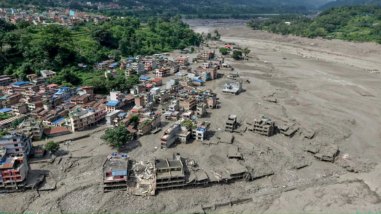
On August 26, 2026, a mass of ice and rock collapsed high in the Himalayas, unleashing a catastrophic torrent through the Nepal–China border region. Water, mud, and boulders surged through the Lhende Khola and Bhote Koshi river system before entering the Trishuli, burying settlements, destroying bridges, and damaging hydropower projects. Within minutes, one of Asia’s most important mountain corridors had become a channel of destruction.
By September 2, Nepal reported over 1,100 fatalities, with thousands missing. Numbers continued to fluctuate as rescuers reached remote villages and searched landslide-clogged hydropower tunnels for bodies. At least 16 were also confirmed dead in Tibet. Nepal’s government estimated that $4 billion-$5 billion will be needed for rebuilding, and that about one-tenth of the country’s power-generation capacity was damaged.
Sympathy alone will not prevent future calamities of this kind. The Nepal disaster exposed a dangerous Himalayan reality: physical hazards cross borders, while responsibility for managing them remains fragmented by national boundaries, political mistrust and chronic underinvestment. The glacier failed miles upstream, but death, displacement and economic losses flowed downstream.
A Disaster Still Under Investigation
Scientists are still studying the sequence of events that caused the flood. Initial reports from the International Center for Integrated Mountain Development (ICIMOD) suggest that a large amount of ice and rock fell into a tributary of the Bhote Koshi called the Lhende Khola. This material either displaced water as it fell or formed a natural dam that later broke.
Analysts are also looking at earthquake records, satellite data, snowmelt conditions, and potential contributions from thawing permafrost. Until more analysis is done, it would be premature to blame this collapse specifically on climate change. Keep in mind the scientific nuance: climate change can change the likelihood and intensity of a hazard without being the sole cause of any one event.
But the bigger trend is hard to deny. Glaciers across the Himalayas are shrinking and receding. Rising temperatures are thawing the permafrost that cements mountainsides together at high elevations. Runoff water from snow and ice is pooling in swelling glacial lakes, many of which are dammed by precarious piles of rock and debris. In these conditions, an avalanche can trigger a landslide that dams a river and releases a lake, creating a disastrous flood miles downstream.
This is the defining characteristic of a cascading disaster: one failure sets off another, with consequences that multiply as they move through densely populated valleys.
Warning Systems That Fail With the Hazard
The Rasuwa disaster also revealed a fundamental weakness in Himalayan early-warning systems. Several monitoring stations in the upper river system were damaged or swept away during the flood. Nepal’s Flood Forecasting Division reportedly received its first warning from the Rasuwa district administration, not from automatic gauges upstream.
Warnings were sent later, but by then the flood was already affecting communities nearest where it started. Emergency response wasn’t too slow. They had no system robust enough to survive contact with the start of the event and communicate the data instantly.
A warning network that disappears in the same flood it is supposed to detect is not an effective warning network.
Sensors in high-risk valleys require redundant power supplies, protected communication channels and satellite backup. Monitoring must combine river gauges, seismic instruments, weather stations, satellite observations and community reporting. Local residents, tourism operators, hydropower workers and border authorities must be integrated into the system rather than treated as passive recipients of centrally issued alerts.
The comparison may be discomfiting, but it is warranted: When an ice- and rock avalanche began barreling toward the Swiss Alpine village of Blatten in 2025, vigilant monitoring of the downward slope movement and prompt evacuation of residents minimized fatalities, despite much of the town being destroyed. Nepal, India, and other Himalayan states sometimes know danger is present but lack the tools, personnel, or infrastructure to act preventively until it’s too late.
The difference is not that European mountains are less dangerous. European communities generally receive far greater investment in observing and managing those dangers.
The Transboundary Vacuum
The Himalayas cannot be protected through national systems alone. The Hindu Kush Himalayan region contains the headwaters of ten major river systems and is often called both the “Third Pole” and Asia’s water tower. A collapse on one side of a border can kill people on another side before national authorities have completed the formalities required to share information.
This became evident as early as July 2025, when a glacial flood originating in Tibet swept away the Nepal–China Friendship Bridge and killed at least nine. Nepal and China subsequently discussed collaborating further and sharing glacial-hazard information. August 2026 was the first test of whether those intentions would be realized, and residents downstream received no actionable alert
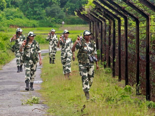
Such arrangements cannot depend on the political warmth of the moment. China, India, Nepal, Pakistan and Bhutan have complicated and often adversarial relationships. Strategic rivalry, disputed borders and the treatment of hydrological data as a national-security asset routinely obstruct scientific cooperation.
But a glacier does not recognize a military boundary. Nor does a flood wait for diplomatic clearance.
Governments across the region must establish a standing obligation to exchange information on glacial lakes, unstable slopes, river blockages, seismic activity and extreme precipitation. This exchange should operate continuously and automatically, not as a favor granted after bilateral negotiations. The data should also reach provinces, districts, hydropower operators and local communities rather than remaining confined to national capitals.
The Basin Extends to Bangladesh
This doesn’t feel like Nepal’s problem to Bangladeshis half a continent away. Originating as the Trishuli, the river is known as the Narayani, then the Gandak before it merges with the Ganges in Bihar. From there, its waters feed into the immense plain divided between India and Bangladesh. Upstream activity thus influences how much water flows downstream, where sediment travels, when floods occur, and where Bangladeshis farm and build.
Negotiations will soon resume to renew the 1996 Ganges Water Sharing Treaty between Bangladesh and India. Treaty signatories will use colonial-era records to decide how much water each country can claim during times of drought, not realizing that the climate has already changed how much water is available. Himalayan glacier melt could increase streamflow during wet seasons, but as glaciers continue to shrink, streamflow could become less reliable during dry seasons. Flood intensity may also increase as more rain falls in heavy downpours, and glacial lakes release water more abruptly. Such shifts can produce spikes that overtop barriers and overwhelm safety systems that are centuries old.
Agreements over sharing a river will need to include cooperative scientific monitoring across the entire basin, not just dividing water at a concrete ribbon cutting. Countries must be prepared to discuss changes in glacial extent, sediment transport, and even flood warning systems all while planning for uncertainty as climate changes. Nepal may not be a party to the Ganges Treaty, but it controls most of the water that India and Bangladesh depend on. Nepal must take part in any scientific dialogue and early warning systems for the entire basin. China must too, before floods on the Tibetan Plateau affect downstream communities in Nepal.
Climate Coloniality and the Question of Responsibility
Together, Nepal and Bangladesh account for barely a fraction of historical global greenhouse gas emissions. But they’re being asked to shoulder massive costs produced by a fossil fuel-heated economy built largely by others. Nepal faces mounting costs to repair roads, bridges, power plants and communities destroyed by last month’s mountain tragedy. In Bangladesh, expense estimates mount to manage rivers increasingly prone to erratic flows and fortify embankments protecting its densely populated delta.
This inequity translates to climate coloniality: the continuation of a world-system where richer countries get most of the benefits of carbon-intensive development and poorer countries bear much of the burden.
The injustice only compounds when finance for tackling climate impacts arrives mainly as loans. Countries shouldn’t be pushed further into debt by having to borrow simply to recover what climate chaos has erased. Funds used to adapt to climate change by monitoring the Himalayas, building resilient infrastructure and moving communities away from growing risk should come primarily in the form of grants, technical cooperation and loss- and-damage support.
Responsibilities also lie with hydropower developers, insurers and international financiers. Projects constructed in flood-prone valleys should help pay for monitoring across the entire basin, not just install gauges to secure their own permits. Risk models must also expand to include not only past flood levels but “compound” disasters that fuse avalanches, landslides, glacial lakes, and blocked rivers.
From Temporary Cooperation to a Permanent Duty
That must not be allowed to happen again. The Rasuwa disaster should spur a permanent Himalayan risk-sharing treaty. Agreements like this would obligate member countries to automatically exchange data, maintain compatible alert systems, collaborate on hazard mapping, and agree on emergency communication protocols.
Countries could contribute financially to a cryosphere monitoring fund to cover the costs of instruments, satellite data fees, paying community observers, and hard-wiring fail-proof communications. High-risk communities and transit routes should be publicly mapped. Communities should map out escape routes within their own neighborhoods. Drill. Officials should disseminate warnings in people’s languages and media platforms.
Most crucially, mountain communities living under glaciers should be engaged as stakeholders in disaster risk management. Many will never be able to just pick up and leave. Their jobs, traditions, and family connections are in the valleys. Governments should instead owe them harm reduction as a basic service, ideally before conditions have already become too perilous to live with.
Tuesday’s tragedy was a disaster for Nepal, yes. But it was also an emergency for China’s far western provinces. And it should be a wake-up call for the entire Himalayan watershed. Scientists will determine how the earth and ice started sliding soon enough. Political leaders must commit to preventing another tragedy first.

Ghulam M. Suhrawardi
Ghulam M. Suhrawardi is the Publisher of South Asia Journal.
Source: https://southasiajournal.net/post/nepal/61680/beyond-nepal-the-urgent-need-for-a-himalayan-risk-sharing-treaty