Indian minister of state for heavy industries and public enterprises Babul Supriyo sees prime minister Sheikh Hasina off at Indira Gandhi International Airport at New Delhi in India on Monday. — Focusbangla photo
India did not resolve the dispute on drawing boundary lines by signing the strip map of Muhurir Char to end protracted row over the implementation of the Land Bounding Agreement in entirety even during prime minister Sheikh Hasina’s visit to New Delhi.
The joint statement issued on Saturday on the state visit mentioned nothing about the issue.
Bangladesh called many a time for Indian cooperation in speedy signing of the strip map resolving the dispute on boundary lines at Muhurir Char in Feni to end protracted row over 10.038 acres of land that put the full implementation of the 1974 Land Boundary Agreement on hold, officials concerned said.
Asked if the issue was raised during the official talks between the two sides, the officials said that Hasina raised the matter in her one-on-one meeting with her Indian counterpart Narendra Modi.
Modi said in his press statement after the official talks, ‘During my visit to Dhaka in June 2015, we had concluded the Land Boundary Agreement. Its implementation is now underway.’
Modi might give necessary instruction in this regard to the land administration, senior officials said.
Bangladesh has been sticking to its position for setting the midstream of the Muhuri River as the boundary line according to the 1977-78 bilateral survey.
Temporary border pillars were put at the disputed land as the authorities concerned from both sides signed the index map of Muhurir Char maintaining the 1977-78 bilateral survey.
The dispute ensued as Indian officials continued pressing to set the present midstream of the river as the boundary line. India also pressed for a new survey to find out the midstream of the river of 2011 when the protocol was signed.
Indian demand for a fresh survey for finding new midstream was not acceptable as the country, in violation of the border guidelines, constructed concrete spurs and embankments along the river bank that had changed the midstream of the river over the years devouring lands in Bangladesh.
Bangladesh wants the issue to be settled according to the 1974 land boundary agreement and the 2011 protocol which allows no change in the map.
The ground demarcation of the boundary as per the interim strip map was supposed to be completed
by the survey departments of the two governments by June 30, 2016 as set out in the instruments of the ratifications of the 1974 land boundary agreement and its 2011 protocol.
Out of 92.14 acres of Muhurir Char land, Bangladesh has got 71.94 acres and the rest 20.20 acres has gone to India after the area was demarcated with the wooden pillars following the 2011 protocol.
All outstanding issues excepting Muhuri Char have already been settled under the land boundary agreement that came into effect with the exchange of its instruments between the two countries during Modi’s visit to Dhaka in June 2016 year.
The two sides have signed 1,174 strip maps to resolve unresolved patches of the land boundary.
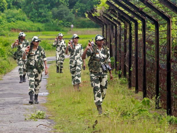
Border-wise, Bangladesh is India’s biggest neighbour, sharing a 4,156km land boundary.
Source: New Age


